 La Mina Trail in El Yunque is one of the most popular hikes in the rain forest along with Big Tree Trail. The reason; they both take you to the beautiful 35 foot waterfall at La Mina Falls where the water flows over huge rocks into a pool, where you can enjoy a cool (make that COLD) refreshing swim.
From the trail head located at the Palo Colorado Ranger Station at KM 12.2 on Road 191, La Mina Trail is approximately 0.7 miles in length with a drop in elevation from 2100ft to 1640ft and should take you an average of 40 minutes (one way). The trail is rated ‘challenging’ in difficulty by the US Forest Services, with a narrow path and a series of steps along the trail. Make sure you are wearing comfortable footwear suitable for trail walking (trainers, sneakers, walking sandals) and be careful along the way as the path can be slippery when wet. When you arrive at the Palo Colorado Ranger Station, it’s a good idea to talk with one of the park rangers about the current trail conditions before you head out on your hike, especially if there has been some recent heavy rain fall.
As soon as you set out on the trail you are immersed into the El Yunque Rainforest with the trail passing several concrete picnic shelters (currently in need of some renovation) that provide benches, running water and a charcoal grill and they also come in handy if it starts to rain. The shelters are close enough to the car park for you to enjoy a picnic or even a BBQ before setting out on your hike or at the end of your hike for that matter.
The trail continues to make its way down through the rainforest meandering along by the La Mina River, offering great views of the river and the flora and fauna that makes up this remarkable rainforest. . Don’t be in a rush to reach the end of the trail, take your time and enjoy the sights and sounds that surround you on the La Mina Trail in El Yunque.

The majority of the trail is not too steep with a series of steps to help with the change in elevation. As you get closer to La Mina Falls and the sound of the rushing water increases you will also encounter the steepest section of La Mina Trail, where you will hike down a series of steps to the end of the trail. Don’t worry; your reward is the views of la Mina Falls and optional swim.
For photos of La Mina Falls, head onto the bridge that joins La Mina Trail with Big Tree Trail and then head carefully down onto the rocks leading to the pool at the bottom of the waterfall. If you plan to venture into the water be careful as the rocks are slippery and there can be large drop offs as you make your way to the water. Also remember that even though it is hot outside the water, the water temperature will be COLD; so be prepared.
 As already mentioned, this is an extremely popular spot for visitors to El Yunque Rainforest, so plan to get to the La Mina Trail early to have La Mina Falls to yourself or at least just a few other savvy folks.
Once it is time for you to leave La Mina Falls you can either continue over the bridge and take the Big Tree Trail or retrace your steps back along La Mina Trail. Retracing your steps is the easier of the two options as you will return to where you left your car. If you take the Big Tree Trail you or someone with you will have to hike back up to the La Mina Trail head (about 1 mile back up Rd 181) to collect your car.
What: La Mina Trail, El Yunque Rainforest
When: Open Daily 7:30am until 6:00pm (closed only Christmas Day). Ranger stations are open 9:00am until 5:00pm. Gates close at 6:00pm
Cost: Free (all the trails in El Yunque are free, though there is a charge if you visit the El Portal, the rainforest visitor center)
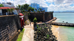
Directions: from San Juan: Hwy 26 to Route 66 (toll) then follow Route 3 east past Rio Grande and turn right on Rd 955 at the El Yunque sign. Turn onto Rd 191 and follow road until you reach the Palo Colorado Ranger Station and La Mina Trail head at Km 12.2
Website: US Forest Services
You can find the La Mina Trail on our interactive map here
Note: Currently the US Forest Service is in the process of renovating the various trails within El Yunque and at the time of publishing this article Big Tree Trail is currently CLOSED. Once the work on Big Tree Trail is complete La Mina Trail will be closed for a few months. You should check with the US Forest Services for the most up to date information regarding trail openings and closures.


4 Responses
i visited el yunque a few days ago,i am back in florida now.i made it to the bottom (la mina).beautiful place but,i am so dissapointed at he fact that there are no signs warning people(specially the elder) that once you make down,it is almost impossible to climb back up. i, and five other men had to cut (break rather) bamboo and use our shirts to make a devise to transport a lady in her 60’s .we placed her in the stretcher like devise and carried her one mile up to safety. but,on the other hand,her daughter was the stupid one for encouraging her to go one mile down the earth!
Thanks for the comment – sounds like you were in the right place at the right time. Agree the section close to the falls is the hardest part. I think the current sign specifies that it is a moderate hike which o think is about right.
Comments are closed.