So what is Panoramio?
Basically it is Google maps with user generated photos. It’s a great way to see what other travelers have found interesting to photograph, here in Puerto Rico.
So if you want to see what San Juan has to offer, just enter ‘San Juan, Puerto Rico’ into the search field and Panoramio will display a set of thumbnails on the left hand side of the screen and on the right a Google Map with small thumbnails indicating the locations where the photographs were taken. You can then zoom in or out of the map, scroll around, just as you would if you were using Google Maps. The page updates with more photos if available.

To see a bigger image of the photo just click on a thumbnail (either in the list on the left or on the map).
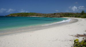
Want to see Luquillo Beach, just zoom out a little and scroll right on the map until you find Luquillo. The page and map updates with photos for that location.

Obviously, the locations shown for Puerto Rico are dependant on what photographs have been uploaded by members of Panoramio, so some areas will have more photos than others. Just remember to zoom into a particular area, as the wider views do not always show the available thumbnails.
Panoramio covers the whole world, so check it out, it may provide some inspiration for your next vacation; if it’s not going to be Puerto Rico.
Note: You do not need to be a member to view the photos and if you would like to add your photos, then simply signup; its free.
More information at Panoramio